U.K. Postcode Areas
- Territory Guide
- U.K. POSTCODE AREAS
Enhance your business efficiency with precise territory analysis. Instead of using broad regions or provinces, leverage smaller, more targeted areas to pinpoint challenges and opportunities.
If you operate within the U.K., then U.K. Postcode Areas are a fantastic asset for your maps! Add this territory overlay to better align and optimize your management. Let’s dive in and get started!
WHAT ARE U.K. POSTCODE AREAS?
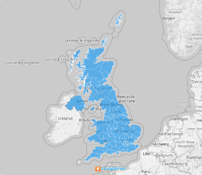
U.K. postcode areas are geographic regions defined by postal codes, representing larger areas encompassing multiple postal districts. The U.K. postcode areas are identified by letters that correspond to the respective regions they represent, like “L” for Liverpool or “RH” for Redhill. In addition to mail sorting, they serve various purposes including census data collection, insurance premium calculations, and route planning for logistics.
Adding U.K. postcode areas to a map can facilitate efficient delivery route planning or logistics management. Understanding postcode areas can also aid in operational planning, such as determining service coverage areas or analyzing market penetration across different regions.
ADD U.K. POSTCODE AREAS
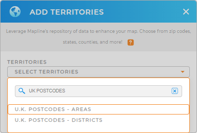
Mapline’s repository is packed with a wide array of wordlwide territory boundaries. First, add a new territory from Mapline’s repository, then type UK POSTCODES into the search bar and select UK POSTCODES- AREAS.
And simple as that, you’re one step ahead to unveiling new insights about your business operations.


Pro Tip: Mapline provides an array of territories for the United Kingdom. Aside from U.K. postcode areas, you can also use U.K. postcode districts, U.K. regions, and London boroughs.
ADD POSTCODE AREA COLORS
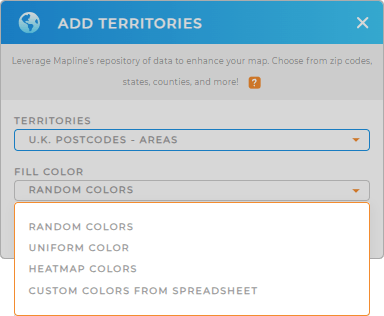
Now, let’s add some life to your map! Colors make your data pop so you can hone into key insights even faster.
In Mapline, you’ll never have to manually color-code your territories.
Just select the type of color styling you need, and BAM! You’re ready to go. If you want further customizations, you can always customize your territory styling later.

GET NEW TERRITORY INSIGHTS
But it doesn’t stop there! Get ready to be wowed by applying these options in territory management:
- Effortlessly risk assessment and mitigation
- Maximize sales activities with advanced routing
- Design sales coverage areas to maximize sales potential


